Impact of Jetson Orin on a Multi-Sensor System for Latitude and Longitude Determination
1. Introduction
The pursuit of accurate and reliable positioning has become increasingly vital across a diverse range of applications, spanning autonomous vehicles and robotics to environmental monitoring and surveying. To achieve the required levels of precision and robustness, multi-sensor systems have emerged as a prevalent solution. These systems integrate data from a variety of sensors, such as celestial navigation instruments, visual odometry cameras, inertial measurement units (IMUs), Lidar, ultrasonic sensors, magnetometers, Global Positioning System (GPS) receivers, and digital maps. The synergistic combination of data from these diverse sources allows for a more comprehensive and resilient determination of a system's position and orientation than relying on any single sensor alone. At the core of such multi-sensor systems lies the central processing unit (CPU), which is responsible for managing the flow of data, executing complex sensor processing algorithms, and performing the computationally intensive tasks associated with sensor fusion. The selection of an appropriate CPU is therefore paramount to the overall performance and capabilities of the navigation system.
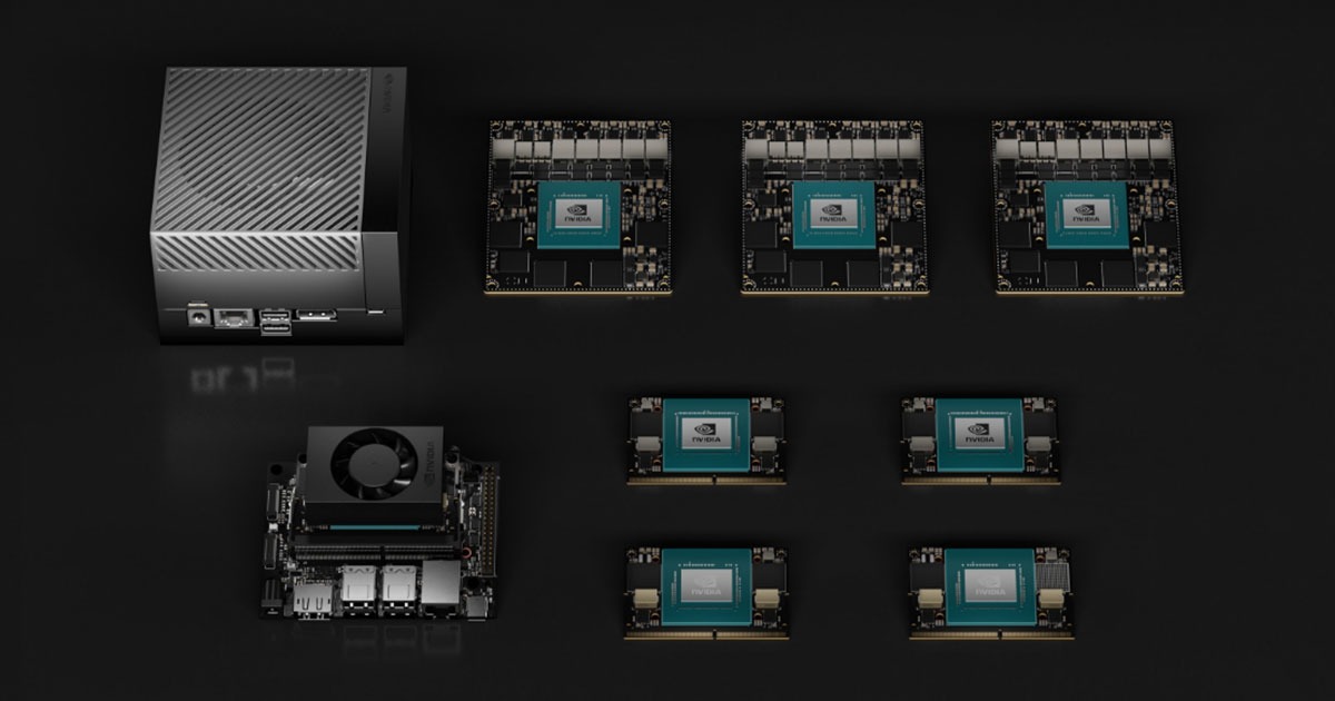
Within the landscape of embedded computing platforms suitable for robotics and artificial intelligence (AI) applications, the NVIDIA Jetson family stands out as a prominent choice. This family offers a spectrum of processing solutions, ranging from entry-level, low-power modules to high-performance systems designed for demanding workloads. The Jetson Nano represents an accessible and energy-efficient option, often favored for its balance of performance and cost. In contrast, the Jetson Orin series offers a significant leap in computational capabilities, catering to applications that require substantial processing power for advanced AI and real-time data analysis. This report aims to provide a detailed analysis of the impact of selecting a Jetson Orin platform over a Jetson Nano for a specific application: a multi-sensor system designed for determining latitude and longitude. By comparing the key hardware specifications of these two platforms and examining how these differences would influence the various components of the navigation system, this report intends to provide valuable insights for making informed decisions regarding hardware selection.
2. Hardware Comparison: Jetson Nano vs. Jetson Orin
A fundamental understanding of the hardware specifications of the Jetson Nano and Jetson Orin is essential to evaluate their suitability for the multi-sensor navigation system. The key differences in processing power, memory, and available interfaces directly impact the system's ability to acquire, process, and fuse data from multiple sensors in real-time.
The Jetson Nano is equipped with a quad-core ARM Cortex-A57 MPCore processor, operating at a clock speed of approximately 1.43 GHz.[1, 2, 3] This provides a foundational level of processing capability suitable for less demanding tasks. In contrast, the Jetson Orin Nano features a more powerful 6-core Arm® Cortex®-A78AE v8.2 64-bit CPU with clock speeds reaching up to 1.5 GHz.[4, 5, 6] Furthermore, the Jetson AGX Orin variants boast even greater CPU power, offering 8 or 12 cores with clock speeds up to 2.2 GHz.[7, 8, 9, 10] The increased number of cores and the more advanced Cortex-A78AE architecture in the Orin family translate to a substantial improvement in parallel processing capabilities and overall computational throughput compared to the Nano. This enhanced CPU performance is critical for managing the concurrent processing demands of a multi-sensor system.
In terms of graphics processing, the Jetson Nano utilizes an NVIDIA Maxwell architecture GPU with 128 NVIDIA CUDA® cores and a maximum clock speed of around 921 MHz.[1, 2, 3] While this GPU can accelerate certain parallel tasks, its capabilities are relatively limited compared to the Orin. The Jetson Orin Nano incorporates an NVIDIA Ampere architecture GPU with up to 1024 CUDA cores and 32 Tensor Cores, with GPU frequencies ranging from approximately 765 MHz to 1.3 GHz depending on the specific Orin model.[4, 5, 6] The Jetson AGX Orin further elevates the GPU specifications, featuring up to 2048 CUDA cores and 64 Tensor Cores.[7, 8, 9, 10] The Ampere architecture represents a significant advancement over Maxwell, offering enhanced performance and efficiency. The substantial increase in CUDA cores in the Orin enables massive parallelization, which is essential for accelerating computationally intensive tasks such as advanced image processing for visual odometry and celestial navigation, as well as for running complex AI models for sensor fusion. The inclusion of Tensor Cores specifically accelerates matrix operations, which are fundamental to deep learning algorithms.
Beyond general-purpose processing, the Jetson Orin family incorporates dedicated Deep Learning Accelerators (DLAs) – NVDLA v2.0 with up to 2 cores, operating at frequencies between 1.2 and 1.6 GHz.[4, 7] These dedicated hardware units are designed to efficiently execute deep learning inference tasks, offloading this workload from the CPU and GPU and improving overall performance and power efficiency for AI-driven functionalities within the navigation system. The Jetson Nano does not feature dedicated AI accelerators in the provided specifications.
Memory is another crucial aspect where the two platforms differ significantly. The Jetson Nano is equipped with 4 GB of 64-bit LPDDR4 memory, providing a bandwidth of 25.6 GB/s.[1, 2, 3] In contrast, the Jetson Orin Nano offers 8GB of 128-bit LPDDR5 memory with a bandwidth of 68 GB/s.[4, 5, 6] The Jetson AGX Orin provides even more substantial memory resources, with options for 32GB or 64GB of 256-bit LPDDR5 memory and a significantly higher bandwidth of 204.8 GB/s.[7, 8, 9, 10] The larger memory capacity and increased bandwidth of the Orin family are essential for handling larger datasets, accommodating more complex algorithms, and ensuring efficient data flow from multiple high-throughput sensors.
The available interfaces also play a critical role in the integration of various sensors. The Jetson Nano offers 12 lanes of MIPI CSI-2, Gigabit Ethernet, an M.2 Key E slot, 4x USB 3.0 ports, a USB 2.0 Micro-B port, and various GPIO, I2C, I2S, SPI, and UART interfaces.[1, 2, 3] The Jetson Orin Nano provides up to 8 lanes of MIPI CSI-2, Gigabit Ethernet, an M.2 Key M slot, an M.2 Key E slot, 4x USB 3.2 Gen2 ports, a USB Type-C port, and similar GPIO, I2C, I2S, SPI, UART, and CAN interfaces.[4, 5, 6] The Jetson AGX Orin expands upon these offerings with 16 CSI lanes, faster CSI speeds, and the inclusion of a 10 GbE port.[7, 8, 9, 10] The Orin family generally provides more high-speed interfaces, particularly the inclusion of USB 3.2 Gen2 and a dedicated M.2 Key M slot with PCIe Gen3/4 support, which are crucial for connecting high-bandwidth sensors like advanced cameras and Lidar, as well as for utilizing fast NVMe SSD storage for data logging and retrieval.
| Specification | Jetson Nano | Jetson Orin Nano (8GB) | Jetson AGX Orin (32GB) |
|---|---|---|---|
| CPU | 4-core Cortex-A57 / 1.43 GHz | 6-core Cortex-A78AE / 1.5 GHz | 8-core Cortex-A78AE / 2.2 GHz |
| GPU Architecture | Maxwell | Ampere | Ampere |
| GPU CUDA Cores | 128 | 512-1024 | 1792-2048 |
| GPU Tensor Cores | 0 | 16-32 | 56-64 |
| AI Performance (TOPS) | N/A | 40-70 | 200-275 |
| Memory (Type/Size/Bandwidth) | LPDDR4 / 4GB / 25.6 GB/s | LPDDR5 / 8GB / 68 GB/s | LPDDR5 / 32GB / 204.8 GB/s |
| CSI Camera Lanes/Max Speed | 12 / 1.5 Gb/s per pair | Up to 8 / Up to 20 Gbps total | 16 / Up to 164 Gbps total |
| USB Ports (Type/Speed) | 4x 3.0 (5 Gbps), 1x 2.0 (480 Mbps) | 4x 3.2 Gen2 (10 Gbps), 1x Type-C | 3x 3.2 Gen2 (10 Gbps), 4x 2.0 (480 Mbps) |
| Ethernet | 1x Gigabit | 1x Gigabit | 1x Gigabit, 1x 10 Gigabit |
| M.2 Slots (Type/Interface) | 1x Key E (PCIe x1, USB 2.0) | 1x Key M (PCIe Gen3 x2/x4), 1x Key E (PCIe Gen3 x1) | 2x Key M (PCIe Gen4 x8/x4), 1x Key E (PCIe Gen4 x1) |
| DL Accelerator | None | 1x or 2x NVDLA v2.0 | 2x NVDLA v2.0 |
3. Impact on Core Navigation Components
The substantial hardware differences between the Jetson Nano and the Jetson Orin have significant implications for the performance and capabilities of each core component of the multi-sensor navigation system designed to determine latitude and longitude.
Celestial navigation processing, which involves identifying stars and using their positions to calculate location, can be significantly enhanced by the increased capabilities of the Jetson Orin. The Jetson Nano's limited processing power might restrict the system to simpler star identification algorithms, potentially leading to slower processing times and lower accuracy, especially when dealing with noisy data or attempting daytime star tracking.[11, 12] More complex algorithms, such as those employing deep learning for star detection and identification [13], or those relying on extensive star catalogs and intricate pattern matching techniques [14, 15], could be too computationally intensive for real-time operation on the Nano. In contrast, the Jetson Orin's superior CPU and GPU power, along with its dedicated AI accelerators, enable the use of more sophisticated algorithms that can achieve higher accuracy and robustness. For instance, algorithms based on one-dimensional vector patterns [15] or convolutional neural networks [16] can be executed more efficiently on the Orin, leading to faster and more reliable star identification. Furthermore, daytime celestial navigation, which requires advanced techniques to filter out sunlight and detect faint stars [17, 18], becomes more feasible with the Orin's enhanced processing capabilities. The larger memory capacity of the Orin also allows for the storage and utilization of more comprehensive star catalogs, which can improve the precision of attitude and position determination.[19]
Visual odometry, the process of estimating motion from a sequence of images, also benefits greatly from the Jetson Orin's increased computational power. The Jetson Nano might struggle to process high-resolution video streams and execute complex visual odometry algorithms like ORB-SLAM3 [20], potentially resulting in lower frame rates and reduced accuracy in relative position estimation. This limitation would be particularly pronounced during fast movements or in visually challenging environments. While GPU-accelerated visual odometry solutions exist for the Nano [21], their performance is likely to be constrained. The Jetson Orin, with its significantly more powerful GPU, can handle more demanding visual odometry algorithms, including those incorporating simultaneous localization and mapping (SLAM) techniques.[22, 23] This allows for the processing of higher-resolution images and video at higher frame rates, leading to more accurate and robust estimates of the system's motion and changes in latitude and longitude over time.[24, 25] Hybrid visual odometry approaches that combine feature-based and direct methods [24, 25] can also be implemented more effectively on the Orin due to its parallel processing capabilities.
The fusion of data from IMUs, Lidar, and ultrasonic sensors to enhance pose estimation can be significantly improved by utilizing the Jetson Orin. The Jetson Nano's processing and memory limitations might restrict the complexity of the sensor fusion algorithms that can be employed in real-time.[26, 27] More advanced techniques, such as tightly coupled Kalman filters or particle filters, could be too computationally demanding for the Nano.[28, 29] The Jetson Orin, with its increased computational power and larger memory, enables the implementation of more sophisticated sensor fusion algorithms, including tightly coupled extended Kalman filters [28, 29], particle filters [27], and even deep learning-based fusion approaches.[27, 30] These advanced algorithms can more effectively combine data from multiple heterogeneous sensors, leading to more accurate and robust estimates of the system's position and orientation.[29, 31, 32] The Robot Operating System 2 (ROS 2), which is well-supported on the Orin [33], provides frameworks and libraries like isaac_ros_nova [34] that further facilitate advanced sensor fusion.
Magnetometer processing for determining heading is likely feasible on the Jetson Nano for basic applications. However, more advanced tasks such as real-time compensation for magnetic anomalies or sophisticated calibration routines [35, 36, 37] might strain its resources. The Jetson Orin offers the potential for implementing more complex magnetometer processing algorithms, potentially incorporating data from other sensors like IMUs to improve heading accuracy and robustness against magnetic interference.[38, 39] Software tools designed for detailed magnetometer data analysis [35] often benefit from greater processing power, which the Orin provides.
Basic GPS data acquisition and processing can be performed on the Jetson Nano. However, for more demanding applications requiring techniques like real-time kinematic (RTK) GPS for centimeter-level accuracy [40, 41] or robust fusion of GPS data with other sensors in challenging, GPS-denied environments [26, 42], the Jetson Orin offers advantages. The Orin's increased processing power can handle the more complex computations involved in RTK and sophisticated multi-sensor fusion for navigation in areas with weak or unavailable GPS signals.
Map-aided localization, which involves using digital maps to refine position estimates, can also be significantly impacted by the choice of processing platform. The Jetson Nano's limited memory and processing power might restrict the size and complexity of the maps that can be utilized and the sophistication of the map-matching algorithms employed.[42, 43, 44] Utilizing large datasets like satellite imagery or detailed 3D maps for localization could be challenging. The Jetson Orin, with its increased memory and computational resources, enables the use of larger, more detailed maps, including high-resolution satellite imagery [43] and digital elevation models.[42] It can also support more advanced map-matching algorithms [45, 46] and even deep learning-based techniques for image matching, leading to improved localization accuracy, especially in complex environments.[42, 47]
Overall sensor fusion, the critical process of combining data from all available sensors to obtain the most accurate and reliable estimate of latitude and longitude, benefits immensely from the Jetson Orin's enhanced capabilities. While the Jetson Nano can perform basic sensor fusion, its limitations in processing power and memory constrain the complexity and number of sensors that can be effectively integrated, particularly in demanding real-time applications. The Jetson Orin's superior computational resources allow for the implementation of advanced, multi-modal sensor fusion strategies [30, 48], including more sophisticated Kalman filters [26, 28], particle filters [27], and deep learning-based approaches.[27, 49] These advanced techniques enable a more accurate, robust, and reliable overall latitude and longitude determination, especially in challenging and dynamic environments where the strengths of different sensors can be intelligently combined to overcome their individual limitations.
4. Integration of Additional Sensors or Higher-Resolution Sensors
The ability to integrate a diverse array of sensors, including those with higher resolution and data rates, is crucial for enhancing the accuracy and robustness of a multi-sensor navigation system. The Jetson Nano's limitations in the number of high-speed interfaces and its processing power can restrict the integration of numerous or very high-resolution sensors that generate large volumes of data. The limited PCIe lanes available through its M.2 Key E slot might also pose a bottleneck for high-performance sensors.
In contrast, the Jetson Orin offers a significant advantage in this regard. With more high-speed interfaces, including a greater number of CSI lanes, faster USB 3.2 Gen2 ports, and dedicated PCIe Gen3/4 connectivity via the M.2 Key M slot [4, 7], the Orin can accommodate a wider variety of sensors. This includes higher-resolution cameras for improved visual odometry and more detailed celestial observations, as well as multiple Lidar units for comprehensive 3D mapping and localization. The enhanced interface capabilities of the Orin allow for the seamless integration of high-bandwidth sensors that provide richer and more detailed environmental data, ultimately contributing to a more comprehensive and accurate navigation system. For example, certain Jetson AGX Orin models can support up to six cameras with high-speed interfaces [7], enabling multi-camera setups for advanced visual perception tasks. Furthermore, the M.2 Key M slot on the Orin allows for the integration of high-speed NVMe SSDs [4] for efficiently storing and processing the large datasets generated by multiple high-resolution sensors.
5. Power Consumption and Physical Size Considerations
Power consumption and physical size are important factors in embedded systems, especially for mobile or resource-constrained applications. The Jetson Nano stands out for its lower power consumption, typically ranging from 5 to 10 watts.[3, 50] Coupled with its compact module size of 69.6 mm x 45 mm [1], the Nano is well-suited for applications with strict power budgets or tight physical constraints, such as small unmanned aerial vehicles or portable devices.
The Jetson Orin, while offering significantly higher performance, comes with increased power consumption. The Jetson Orin Nano typically consumes between 7 and 15 watts [6] or 5 and 10 watts in lower power modes [5], while the more powerful Jetson AGX Orin can range from 15 to 60 watts depending on the workload and model.[7] The physical size of the Orin modules is also slightly larger than the Nano; the Orin Nano shares a similar footprint of 69.6 mm x 45 mm [5], whereas the AGX Orin module measures 100mm x 87mm.[7] This trade-off between performance and power/size needs careful consideration based on the specific requirements of the latitude and longitude determination system. While the Nano's low power consumption is advantageous for battery-operated applications, the Orin's higher power draw is often an acceptable compromise given the substantial performance gains it provides, especially for complex, real-time navigation tasks. The relatively small increase in physical size for the Orin Nano compared to the Nano also makes it a viable option for many embedded applications where performance is prioritized.
6. Software Libraries and Development Tools
The availability and performance of software libraries and development tools are critical for efficiently developing and deploying a complex multi-sensor navigation system. The Jetson Nano is supported by the NVIDIA JetPack SDK [3, 51], which includes essential libraries such as CUDA, cuDNN, TensorRT, and OpenCV. These tools enable the development of applications that leverage the Nano's GPU for accelerated computing. However, due to its hardware limitations, the Nano might face challenges in running the latest versions of these libraries or more advanced AI/ML frameworks with optimal performance.
The Jetson Orin family benefits from full support by the latest NVIDIA JetPack SDK [51, 52], which is specifically optimized for its high-performance architecture. This includes the most recent versions of CUDA, cuDNN, TensorRT, and OpenCV, ensuring access to the latest features and performance enhancements. Furthermore, the Orin platform offers excellent compatibility and performance with advanced robotics frameworks like Isaac ROS [34] and is well-suited for running modern AI/ML frameworks like TensorFlow [53] and PyTorch.[53] The availability of comprehensive development tools, including the NVIDIA SDK Manager [54, 55], and optimized libraries significantly streamlines the development process and enables the implementation of cutting-edge navigation algorithms with greater efficiency. The ongoing software optimizations provided by NVIDIA, including updates like the Jetson Orin Nano Super [52, 56], further enhance the platform's capabilities for demanding AI and robotics applications. Libraries specifically designed for efficient execution of tasks like large language models on the Orin [57] highlight the platform's growing software ecosystem for advanced AI-driven functionalities.
7. Potential Advantages and Disadvantages Summary
The choice between the Jetson Orin and the Jetson Nano for a multi-sensor latitude and longitude determination system involves a trade-off between performance and resources.
- Advantages of Jetson Orin:
- Significantly enhanced processing power (CPU, GPU, dedicated AI accelerators) allows for the execution of more complex and accurate navigation algorithms in real-time.
- Larger memory capacity and higher bandwidth enable the processing of larger datasets and the use of more sophisticated models for sensor fusion and localization.
- More high-speed interfaces facilitate the integration of a wider variety of advanced and high-resolution sensors, providing richer environmental data.
- Better support for advanced AI/ML techniques, crucial for implementing state-of-the-art sensor fusion, perception, and localization algorithms.
- Access to the latest and optimized software libraries and development tools within the NVIDIA JetPack and broader ecosystem streamlines development and maximizes performance.
- Disadvantages of Jetson Orin:
- Higher power consumption necessitates more robust power supplies and thermal management solutions.
- Potentially larger physical size compared to the Nano, which might be a concern for highly compact systems.
- Higher cost, which can be a significant factor for budget-constrained projects.
- Advantages of Jetson Nano:
- Lower power consumption makes it suitable for battery-powered and energy-efficient applications.
- Smaller physical size is beneficial for designs with tight space limitations.
- Lower cost makes it an attractive option for initial prototyping and less computationally demanding applications.
- Disadvantages of Jetson Nano:
- Limited processing power and memory can restrict the complexity of algorithms and the number of sensors that can be effectively utilized.
- May struggle with real-time processing of high-resolution sensor data and advanced sensor fusion techniques, potentially impacting accuracy and robustness.
- Constraints on the number and resolution of sensors that can be integrated might limit the richness of the data available for navigation.
- Limited support for the latest AI/ML techniques and software libraries might hinder the implementation of cutting-edge navigation algorithms.
Conclusions
For a multi-sensor system dedicated to accurate and reliable latitude and longitude determination, the Jetson Orin presents a compelling advantage over the Jetson Nano. While the Jetson Nano offers benefits in terms of power consumption, size, and cost, the Jetson Orin's significantly enhanced processing power, memory capacity, and interface capabilities are crucial for handling the computational demands of advanced sensor fusion algorithms, high-resolution sensor data, and sophisticated navigation techniques. The ability to implement more complex algorithms for celestial navigation, visual odometry, IMU/Lidar/ultrasonic fusion, magnetometer processing, GPS processing, and map-aided localization on the Orin directly translates to the potential for higher accuracy, greater robustness, and the integration of a wider array of advanced sensors. Furthermore, the Orin's superior support for the latest software libraries and development tools, particularly in the realm of AI and robotics, provides a strong foundation for building a state-of-the-art navigation system. While the higher power consumption and cost of the Jetson Orin need to be considered, the substantial performance gains and expanded capabilities it offers make it a more suitable choice for applications demanding high accuracy and reliability in latitude and longitude determination through the integration of multiple sensors.